Drone Photography in Kashmir: Rules, Regulations & Best Spots
Few landscapes on Earth rival Kashmir's visual drama—mirror-still lakes cradled by snow-dusted peaks, saffron meadows bleeding into pine forests, and chinar avenues blazing gold in autumn. It's no surprise that drone photographers dream of capturing this valley from above. But Kashmir's airspace is among India's most sensitive, and flying here demands more homework than in most destinations.
This guide breaks down everything you need to know about drone photography in Kashmir in 2026: the regulatory framework, the permits you'll need, the zones you must avoid, and—most importantly—the aerial spots that make all the paperwork worthwhile.
Understanding India's Drone Regulatory Framework
Before you pack your quadcopter, you need to understand the national rules that govern every drone flight in India.
India's drone operations fall under the Drone Rules, 2021, administered by the Directorate General of Civil Aviation (DGCA). All compliance—registration, pilot licensing, and flight permissions—runs through the Digital Sky Platform (digitalsky.dgca.gov.in).
Drone Categories by Weight
India classifies drones into categories based on maximum all-up weight (including payload):
- Nano (under 250 g): The most relaxed rules—no registration, no pilot licence, and no flight permission required for operations below 50 feet AGL in uncontrolled airspace. However, nano drones must still respect no-fly zone restrictions.
- Micro (250 g–2 kg): Registration on Digital Sky is required. No remote pilot licence needed for non-commercial use.
- Small (2–25 kg): Full registration, remote pilot licence, and flight permissions required.
- Medium and Large (25 kg+): Stringent requirements; rarely relevant for photography hobbyists.
Most consumer camera drones (DJI Mini series, Air series, Mavic series) fall into the Nano or Micro categories.
The Airspace Color Code
The Digital Sky platform divides Indian airspace into three zones:
- Green Zone: No permission required for drones up to 400 feet AGL. This is where most recreational flying happens.
- Yellow Zone: Controlled airspace (typically near airports within 8–12 km). Prior permission from the concerned Air Traffic Control authority is required.
- Red Zone: No civilian drone operations unless explicitly authorised by the Central Government. These include areas near borders, military installations, and critical infrastructure.
Key 2025–2026 Updates
- The NPNT (No Permission, No Takeoff) mandate is strictly enforced for all drones above the Nano category.
- A Draft Civil Drone (Promotion and Regulation) Bill, 2025 has been introduced, proposing stricter penalties—potentially up to three years of imprisonment or fines up to ₹1 lakh for unregistered drone use.
- Insurance is now expected for drones above Micro category, with annual premiums starting around ₹1,500–₹3,000 for hobby micro drones.
Why Kashmir Has Extra Restrictions
Here's where things get more complex. Kashmir's unique geopolitical context means that even areas marked Green on the Digital Sky map may be subject to additional local restrictions.
Jammu & Kashmir is heavily restricted for drones due to military presence and security concerns. Even green zone flying may be stopped by local authorities, and prior coordination with local police is strongly advised.
In practice, many districts require prior written permission from the District Magistrate and local police station—even in areas that appear Green on Digital Sky. This is a layer of regulation that goes beyond what most Indian states require.
What You'll Likely Need
- Recreational/hobby flights: Written permission from the District Magistrate (DM) and local police, in addition to standard DGCA compliance.
- Commercial filming: A formal file including drone details (make, serial/UIN), pilot credentials, flight area maps, time window, takeoff/landing points, and security clearance from concerned agencies.
- Carry original ID at all times—both Indian nationals and foreign visitors.
Definite No-Fly Areas in Kashmir
- Near the Line of Control (LoC) and international borders
- Military camps, police stations, and army installations
- Airports and helipads (including Srinagar International Airport's surrounding zone)
- Government buildings and bridges
- Crowded city areas (often fall under Red/Yellow zones)
- Wildlife sanctuaries like Dachigam National Park
Penalties for Violations
Authorities can seize your drone and initiate legal action under the Aircraft Act and Drone Rules. In a security-sensitive region like Kashmir, filming near sensitive locations can attract particularly serious consequences.
Best Aerial Spots for Drone Photography in Kashmir
Now for the part you've been waiting for. These locations offer extraordinary aerial potential—but remember: treat this list as inspiration first, and seek formal permissions before any aerial work.
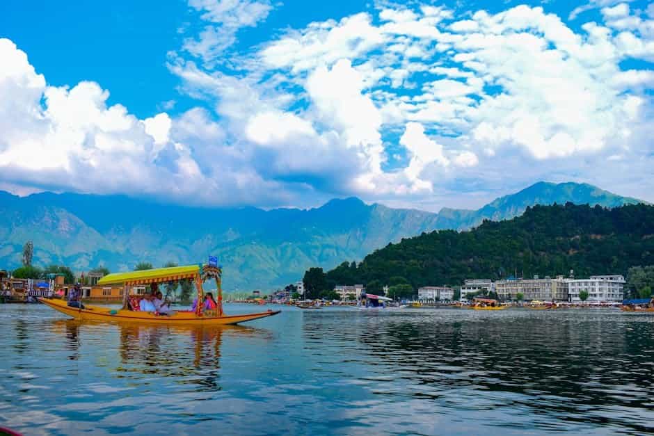
1. Dal and Nigeen Lakes, Srinagar
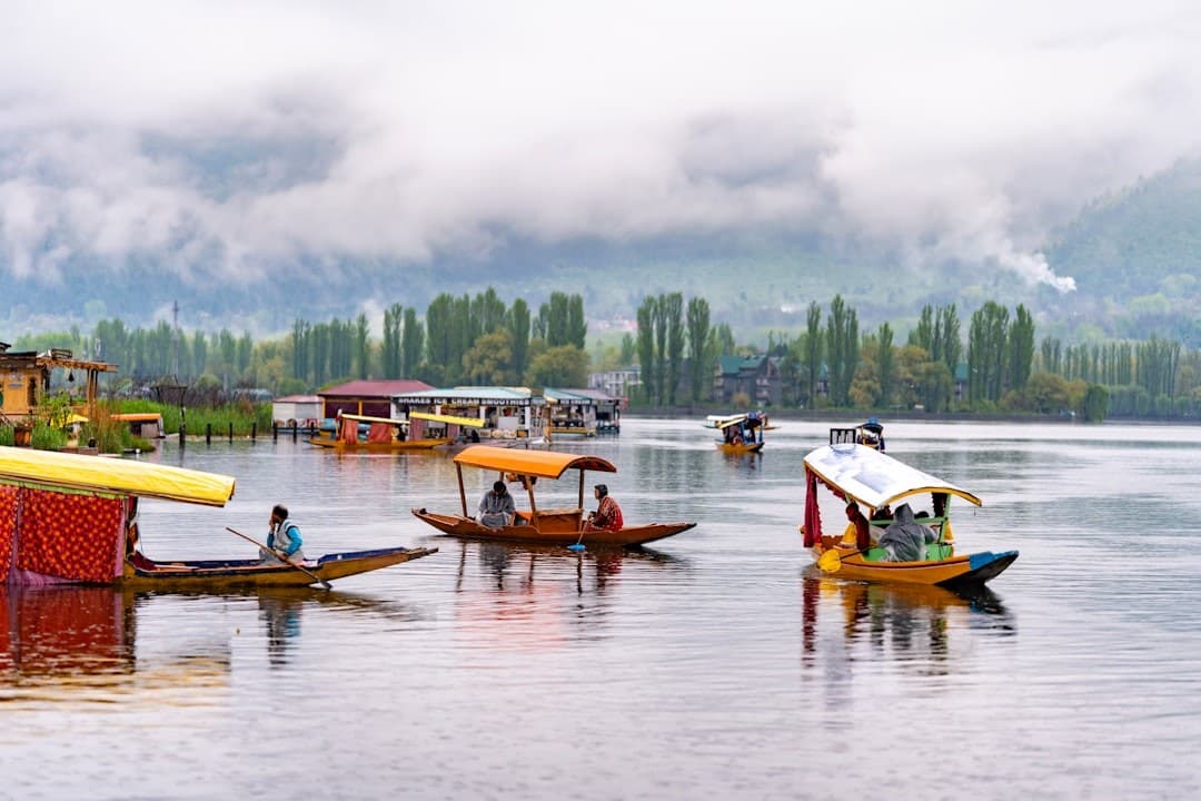
The iconic heart of Kashmir. From above, the geometric patterns of floating gardens, the graceful arcs of shikaras, and houseboats nestled among lotus beds create compositions that are impossible from ground level. Important caveat: Srinagar's urban airspace is heavily restricted, so permissions here are particularly difficult to obtain.
- Best light: Golden hour at sunrise, when mist lifts off the water
- Season: Year-round; frozen winter surfaces offer a completely different mood
2. Gulmarg Meadows and Apharwat
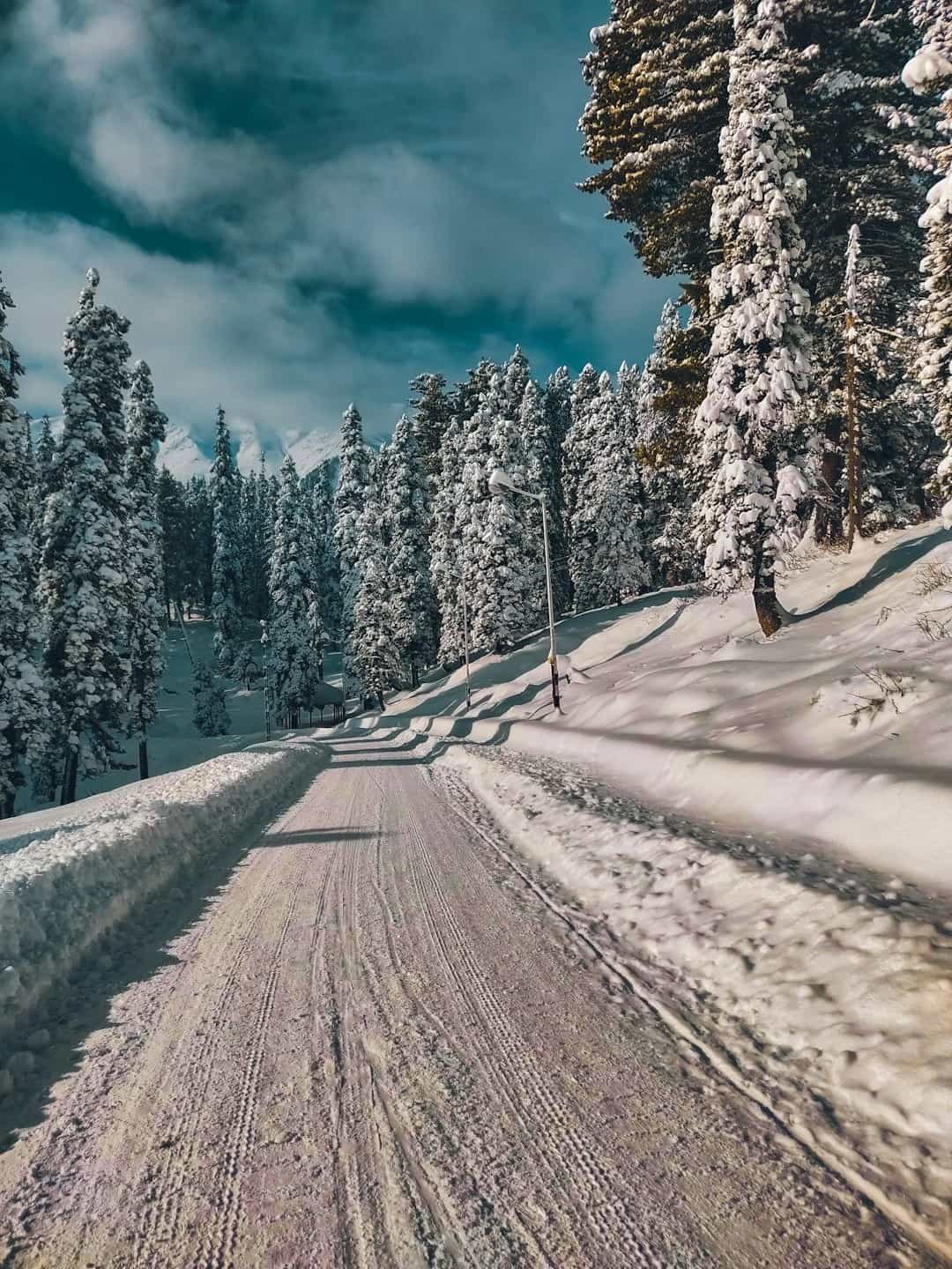
Gulmarg's vast alpine meadows, ringed by deodar forests and backed by the Apharwat ridge near 3,980 m, offer a photographer's paradise. The contrast between snow-laden slopes in winter and wildflower carpets in summer is staggering from the air.
- Best light: Early morning before winds pick up (strong gusts are common at altitude)
- Season: Winter for powder-white drama; June–July for wildflower meadows
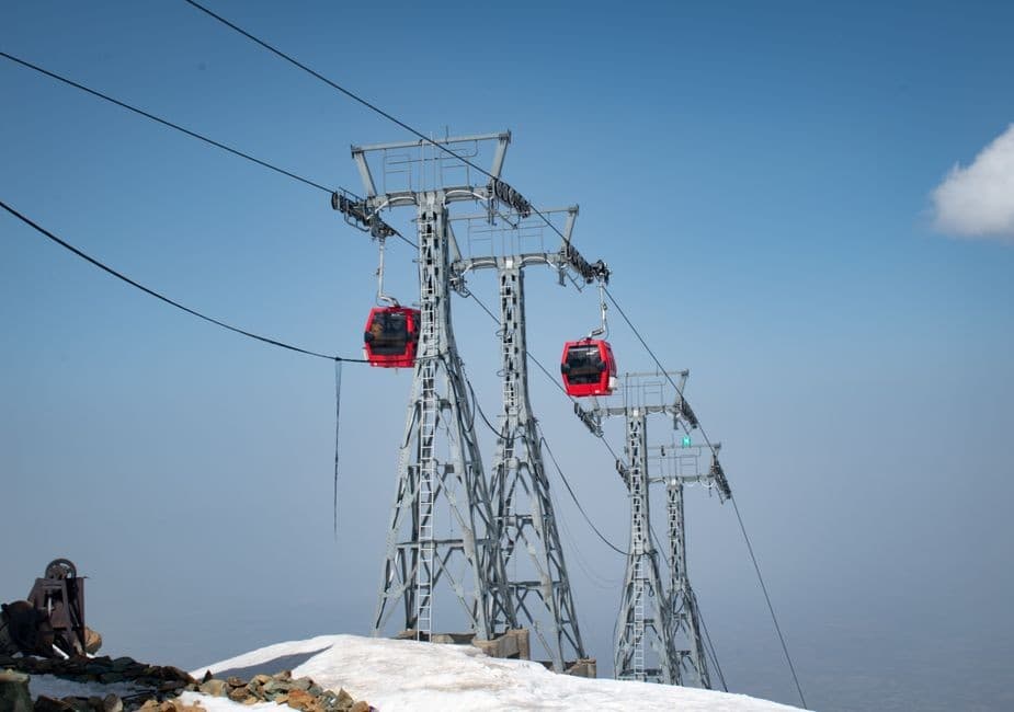
- Tip: If drone permissions prove elusive, the Gulmarg Gondola offers sweeping vistas that rival aerial shots
3. Pahalgam: Lidder Valley, Betaab Valley, and Aru
The Lidder River threading through pine-forested valleys, the cinematic bowl of Betaab Valley, and the pastoral charm of Aru village—these locations offer layered compositions of water, forest, and mountain.
- Best light: Late afternoon when side-light sculpts the valley walls
- Season: April–June for flowing streams and green meadows; October for golden foliage
4. Sonamarg and Thajiwas Glacier
The "Meadow of Gold" lives up to its name from the air. The Sindh River valley, glacier-fed streams, and high meadows surrounded by snow peaks create dramatic scale.
- Best light: Morning, when the glacier catches the first rays
- Season: May–September (road access typically closed in winter)
5. Yusmarg and Doodhpathri
These off-the-beaten-path meadows—rolling pastures and pine forests without the tourist density of Gulmarg—offer some of the best chances for drone permissions, as they are rural, open, and far from sensitive installations.
- Best light: Any golden hour; the undulating terrain catches light beautifully
- Season: May–October
6. Aharbal Waterfall
A thundering cascade framed by dense forest near Kulgam. The gorge and waterfall from above reveal patterns invisible from the viewing platform.
- Best light: Midday (the gorge is shaded early and late)
- Season: Post-monsoon (September–October) for maximum water flow
7. Gurez Valley (Extremely Restricted)
The Kishanganga River winding through postcard villages is starkly beautiful—but this is an extremely sensitive border belt and is generally off-limits for drones. Admire from the ground.
Practical Tips for Drone Photographers in Kashmir
Before You Travel
- Check the Digital Sky airspace map for your specific locations—zone classifications can change.
- Contact the District Magistrate's office for the districts you plan to fly in and request written permission well in advance.
- Register your drone on the Digital Sky platform if it weighs over 250 g and obtain your UIN.
- Download offline maps—data connectivity can be unreliable in remote Kashmir valleys.
On the Ground
- Carry all documentation: UIN certificate, DM permission letter, original ID, and flight plan details.
- Inform local police before flying, even if you have DM clearance.
- Never fly near security installations, checkpoints, or military convoys—this cannot be overstated.
- Avoid crowds: Flying over people is prohibited and particularly sensitive in Kashmir.
- Watch the weather: Mountain winds can be sudden and fierce, especially at altitude in Gulmarg and Sonamarg.
- Battery performance drops significantly in Kashmir's cold winters (–6 to 8°C in valleys, colder at altitude). Carry extra batteries and keep them warm.
Consider Hiring Local Professionals
Many travelers find it practical to hire licensed local drone operators who are familiar with the permission process. Reputable tourism boards and portals can help you find verified professionals. This approach saves you the bureaucratic headaches and ensures compliance.
Alternatives When You Can't Fly
Kashmir offers plenty of ways to capture elevated perspectives without a drone:
- Gulmarg Gondola for sweeping panoramas
- Shankaracharya Temple and Pari Mahal for city-and-lake overlooks
- Handheld gimbals for cinematic ground-level motion
- High-altitude trek viewpoints on routes like Kashmir Great Lakes or Tarsar–Marsar
Best Seasons for Aerial Photography in Kashmir
| Season | Temperature | Aerial Highlights |
|---|---|---|
| Spring (Apr–Jun) | 15–28°C | Tulip bloom, flowing streams, open meadows, clear skies |
| Autumn (Sep–Nov) | 5–20°C | Golden chinar foliage, saffron fields, crisp visibility |
| Winter (Dec–Feb) | –6 to 8°C | Snow-covered landscapes, frozen lakes, dramatic contrast |
| Monsoon (Jul–Sep) | 14–25°C | Lush green valleys, but rain and cloud can ground drones |
Autumn and late spring offer the best combination of visual drama, stable weather, and comfortable flying conditions. Winter delivers the most photogenic scenes but challenges batteries and pilot comfort alike.
Final Thoughts: Fly Responsibly, Capture Respectfully
Kashmir's beauty is unmatched, and the temptation to launch a drone over every meadow and lake is real. But this is a region where compliance isn't optional—it's essential. The rules exist for legitimate security reasons, and respecting them protects both you and the communities you're visiting.
Here's your action checklist:
- Register your drone on Digital Sky and obtain your UIN (if over 250 g).
- Check the airspace map for every planned location.
- Apply for District Magistrate and police permissions well before your trip.
- Hire a licensed local operator if the paperwork feels overwhelming.
- Fly only where and when you have explicit permission.
- Respect the landscape—avoid disturbing wildlife, communities, and sensitive sites.
With thoughtful preparation and respect for the regulations, you can return from Kashmir with aerial footage that does justice to one of the most beautiful places on the planet. And even if your drone stays grounded, this valley rewards every photographer—from every angle—with scenes that feel like they belong in a dream.
Leave a Comment
Explore Kashmir
Ready to plan your trip? Check out our complete travel guide and packages.