Wangdue Phodrang, Bhutan
Wangdue Phodrang is a historically and administratively important dzong-town in central Bhutan, founded as a strategic fortress and regional seat of governance. Located at a key crossroads where routes to eastern and western Bhutan converge, it has served as an important cultural and political hub since the 17th century. The surrounding district is ecologically diverse, containing high-altitude valleys, temperate forests, and seasonally important wetlands that are home to unique wildlife.
Last updated: 16 Jan 2026


Places to visit
- Wangdue Phodrang Dzong (historic fortress and administrative complex)
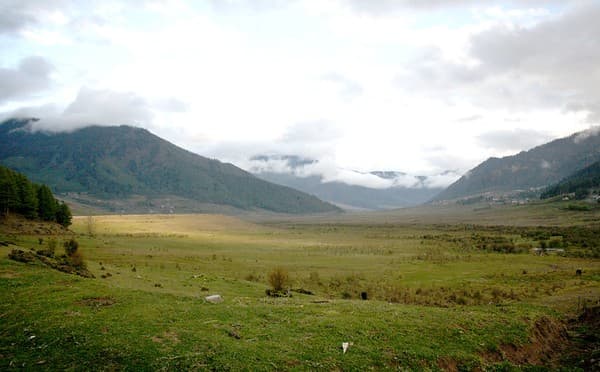
- Phobjikha (Gangtey) Valley – wintering ground of the black‑necked crane
- Gangtey Goempa (Gangtey Monastery) in Phobjikha
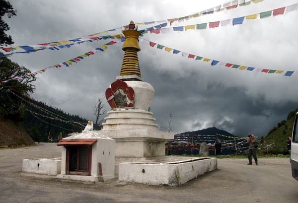
- Dochula Pass and its 108 chortens (nearby scenic stop en route to Thimphu)
- Traditional rural villages, terraced fields and market areas
Unique Aspects
- Distinctive dzong architecture combining administrative, religious and defensive functions
- Expansive valley landscapes and panoramic Himalayan views
- Seasonal wildlife highlights — notably the black‑necked crane in Phobjikha
- Rich intangible culture: mask dances, monastic festivals, and local handicrafts
Things to do
- Guided cultural tour of the dzong precincts and local temples (respectful dress required)
- Birdwatching and wildlife photography in Phobjikha Valley (seasonal)
- Short hikes to viewpoints and through village trails
- Visiting local markets and meeting artisans (textiles, bamboo & wood crafts)
- Scenic drives — especially via Dochula Pass between Wangdue and Thimphu
Festivals & Events
- Wangdue Phodrang Tshechu (local tsechu at the dzong — dates vary by lunar calendar)
- Black‑Necked Crane Festival (Phobjikha/Gangtey) celebrating the migratory cranes — usually in winter)
- Seasonal village festivals and religious ceremonies tied to the agricultural calendar
Best Time to Visit
Late October to April for clearer skies, festivals, and to see the black‑necked cranes (winter); May to September is greener and good for lower‑altitude trekking but includes the monsoon season (heavier rain).
Weather Conditions
Montane climate: cold winters especially at higher elevations, mild summers, and a monsoon period (roughly June–August) with heavier rainfall. Day–night temperature ranges can be large; higher valleys remain chilly.
Accessibility
Nearest international airport: Paro (Paro International Airport). Typical access is by road from Paro or Thimphu; travel times vary with road conditions (expect several hours by car depending on route). Public buses serve some routes; most visitors use private vehicles arranged by tour operators. Roads can be winding and weather‑dependent — winter snow or monsoon rain can affect travel times.
Recommended Duration
1 day to see the town and dzong precincts; 2–3 days recommended to include nearby Phobjikha Valley/Gangtey and to experience local culture; longer (4+ days) if planning treks or exploring more of the district.
Clothing & Gear Tips
Layered clothing, a warm jacket for mornings/evenings, waterproof outer layer for monsoon season, comfortable walking shoes, sun protection, and binoculars for birdwatching.
Local Food & Souvenirs
Try ema datshi (chili and cheese), local red rice, buckwheat dishes and butter tea (suja). Souvenirs include handwoven textiles, local handicrafts, wooden and bamboo items, and seasonal preserves or honey from village producers.